
The River Lea has long been a multi-use space, shared by all kinds of craft. In recent years, however, the Canal and River Trust has emphasised the rights of some river users over others. This is especially true as the Trust attempts to force through bans on mooring on the site of its “Water Safety Zones”, which will prevent itinerant boat dwellers from mooring in these locations for the 14 days which applies elsewhere on the waterways.
The Trust claims that more “no mooring” sites are necessary for the safety of other canal users, such as rowers and kayakers. This is despite scant evidence that moored boats cause collisions and the fact that the Lea Navigation is among the widest waterways of the country.
Moreover, boats and large barges have been using and mooring on the Lea for many years, including in places where the Trust is calling to ban moored boats. The inset photos show boats and industrial barges moored at some of these very locations.
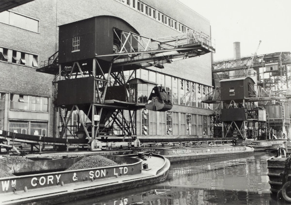
Figure 1, from between 1950 to 1969, shows barges unloading at Hackney Power Station, near Millfields Park in Clapton, now the site of a recycling centre. Two stretches of canal here are threatened with restriction under the Trust’s “Safety Zones”, where previously widebeam barges have moored for access.
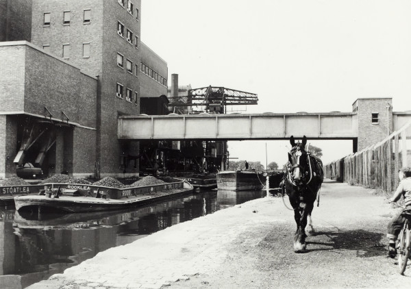
1950-69
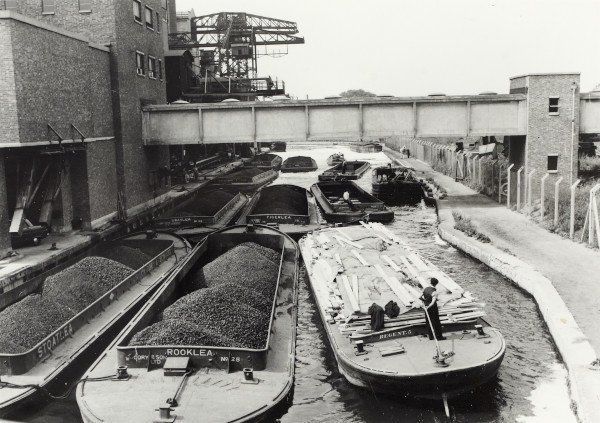
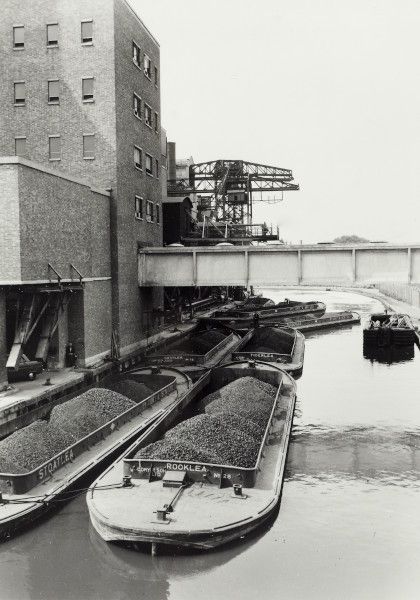
Judging from other photos from this period (Fig.4, 5, 6), this section of the navigation near the former power station has been used by considerably larger boats than tend to operate on the river today. Not only this, but Lea Rowing Club, some of the most vocal proponents of the “Safety Zones”, operated on the navigation during these years, when timber and coal barges were evidently on the water too. The waterways have been shared for some time, and it’s unreasonable that this should change now.
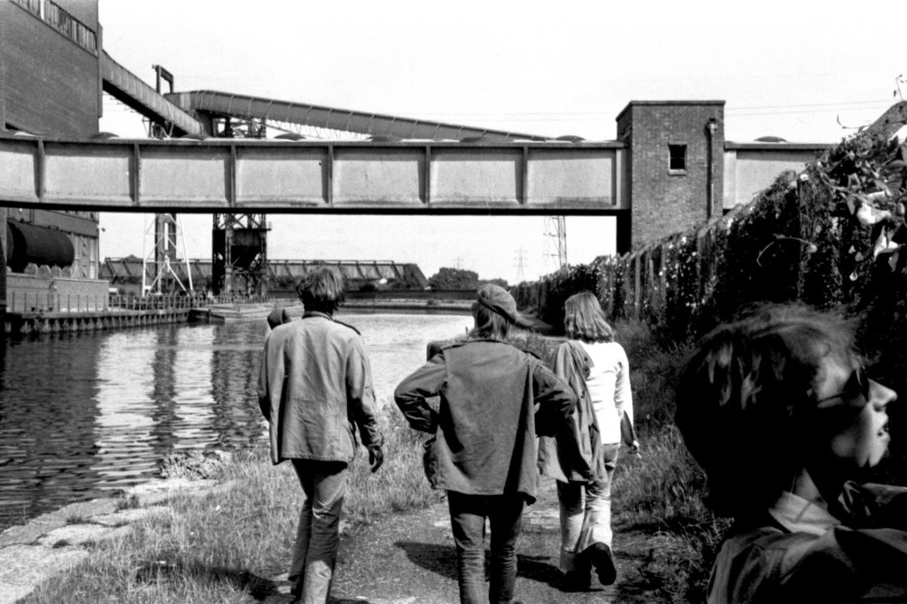
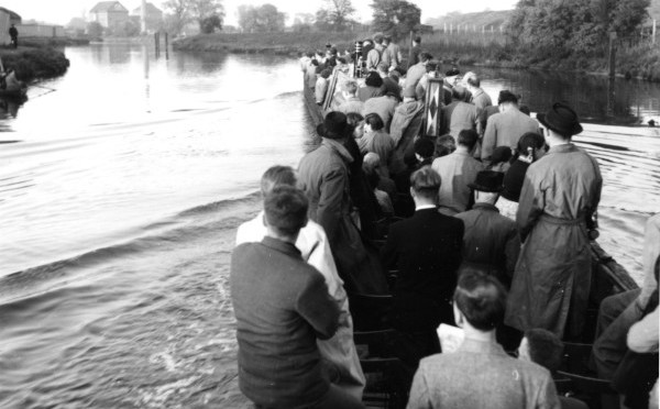
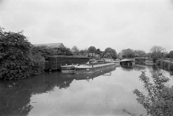
In a later photograph from 1973 (Figure 2), a barge is visible moored on the inside of the shallow bend leading round to Milllfields Park. Across from the Princess of Wales pub, where the CRT is proposing no mooring sections, figure 3 shows barges double-moored on the offside. Before the Lea Bridge was constructed, the river was crossed at this site by Jeremy’s and Smith’s ferries as early as 1747, according to A History of the County of Essex: Vol. 6. Passenger boats were therefore mooring at this site as long as over 200 years ago.
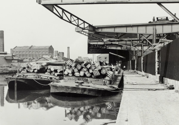
The scene in figure 7 will be familiar as the view from the eastern bank of the river in Hackney Wick, opposite Omega Works and looking north toward Barge East. This photo also dates from between 1950 and 1969, and shows wide-beam timber barges moored at a site which the Trust considers unfit for mooring of boats which are homes, but perfectly suitable for more lucrative restaurant boats and water sports landings.
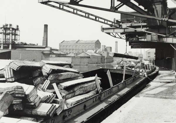
The Canal and River Trust continues to claim that canal boats and liveaboard boaters have not been able to moor in its “Water Safety Zones”, for the benefit of other users. Clearly, there have been large craft sharing the river with others for some decades now.
NBTA London needs your support to carry on our work. Please get in touch here if you would like to volunteer with us. Alternatively your donations are vital to us supporting boaters with their legal case work, campaign banners and other printed material as well as events. You can help us with your donations online here
